This series began in response to feedback from users who, despite having adopted 3D scanning, said, “We don’t know how to make use of the models we’ve scanned.”
The latest video in this three-part series focuses on “how to draw scaffolding layout diagrams ” and “ the correct way to depict vehicles ”—two topics that frequently come up on construction sites.
Using these techniques will dramatically reduce the time it takes to gather material lists from subcontractors and obtain quotes.
In this article, we’ll introduce specific practical tips that make tasks surprisingly smooth in situations where an accurate visualization of the current status is required—such as when applying for a road use permit at a police station.
Theme 3: Instantly Visualize the Current Status of Both Scaffolding and Vehicles
By utilizing Scanatmeasurement lines, the following on-site challenges are resolved instantly, dramatically reducing work time.
♦︎“Accurate and fast” road width measurements
To apply for a road use permit, you must accurately measure the “road width (distance between the inner edges of the curbs).”
Scanat, you can visualize the width from curb to curb and road occupancy regulations directly on the screen.
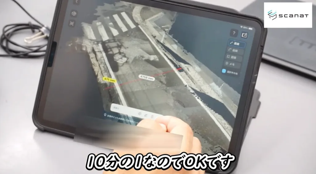
"If the road is 4.75 meters wide, you can extend the scaffolding toward the road up to 0.475 meters, which is one-tenth of that width.
It’s extremely convenient on-site because you can tell at a glance what’s allowed and what isn’t."
Before heading to the job site, you can accurately determine the dimensions required for a road use permit application right on the spot, ensuring a smooth application process without any rework.
♦︎You can sketch out a scaffold with just a few taps
Even scaffolding layout diagrams—which are crucial for temporary construction planning—can be easily created by utilizing Scanat measurement lines.
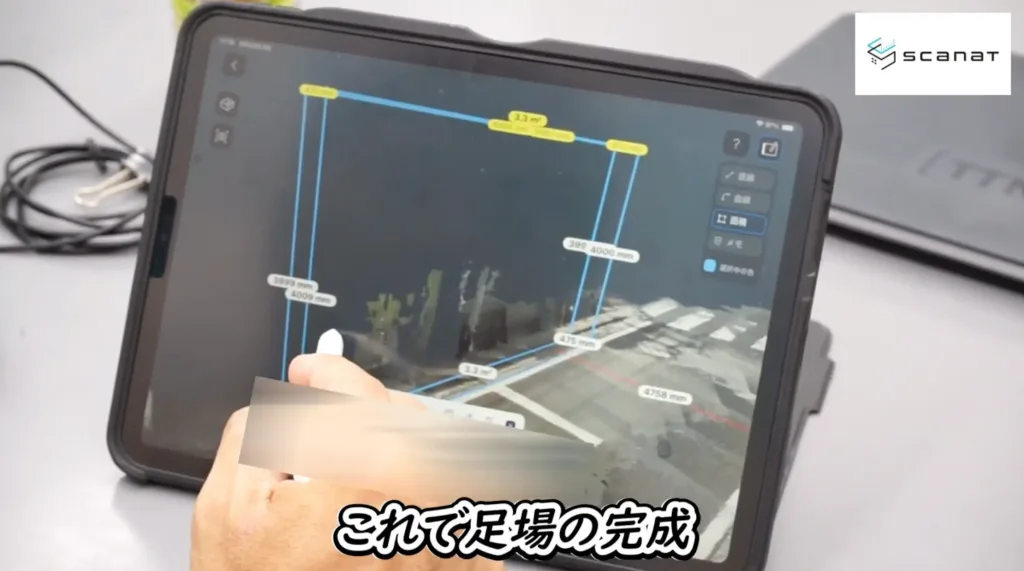
"The key point is that while you can sketch things out intuitively and quickly, anyone—whether it's a site supervisor or a subcontractor—can create drawings with the same level of precision."
Anyone can create scaffolding layout diagrams with the same level of accuracy in just a few taps, eliminating errors in communicating information to subcontractors and significantly reducing the time it takes to obtain quotes.
♦︎Even drawing cars is easy—from "2D to 3D"
Vehicle representations are essential for explaining parking locations and ensuring clear traffic flow.
Scanat, you can instantly create vehicles within a 3D model based on numerical data.
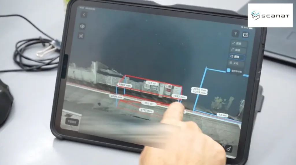
"While it can be difficult to convey a sense of a vehicle's height or the feeling of being enclosed using only 2D renderings,
presenting it in 3D makes it significantly easier to explain to partner companies and clients."
Sharing a three-dimensional representation of a vehicle’s height and sense of scale simplifies on-site safety management and explanations to clients, making it easier to convey the intended image.
▼Click here for the third installment of the series
- Tips for Completing a Road Use Permit Application in a Flash
- Methods for Representing Scaffolding Using Measurement Lines
- How to Share Vehicles in 3D
In Part 4, our theme is “Preventing Chaos on Site!”…
- How should we plan the renovation of a bathroom adjacent to a staircase at a site where there are no blueprints?
- Use color-coding and note-taking features to accurately visualize requests, equipment requirements, and the scope of protective measures.
- Let's visualize worker traffic patterns to eliminate confusion during construction.
We will continue to present specific examples—such as these—that help make it easier to understand and share information about on-site conditions.
Archive Information
In the first and second installments of this series, we introduce practical tips that are “truly useful” in the field.
・Part 1: “Sharing Information with Internal Teams and Partner Companies Using the Note Feature”
・Part 2: “Layout Planning for Temporary Facilities and Calculating the Quantity of Water Supply Piping”
If you haven't seen it yet, please be sure to watch it.
▶︎Learn from Mr. Yoshigaki! Click Scanat for " Tips for Using Scanat (Part 1 )"
▶︎Learn from Mr. Yoshigaki! Click Scanat for " Tips for Using Scanat (Part 2 )"
▶︎Case Study: How Yoshigaki Construction Co., Ltd. Uses Scanat